The River Nile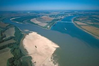
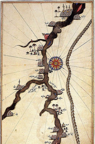
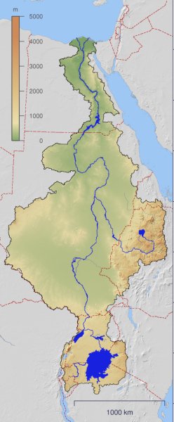
The River Nile is the world's longest river at 4160 miles in length and discharges 680,000 gallons of water into the Mediterranean Sea every second. Taking its name from the Greek word 'Neilos' (river valley), the actual source has always been a matter of dispute because the River Nile has two main tributaries; the White Nile whose source is believed to be the Ruvyironza River of Burundi which flows into Tanzania's Kagera River and from there into Lake Victoria, Africa's largest lake and then into South Sudan and the Blue Nile which discharges from Lake Tana in Ethiopia and flows into Sudan from the southeast. The two rivers meet near the capital of Khartoum in Sudan (above). You can see why the two joining rivers are called Blue and White Nile by a look at this image.
 The White Nile gets it name from the light grey sediment that's suspended in its water whilst the Blue Nile flows through more fertile soil. The Nile became important many thousands of years ago as climate change swept across northern Africa. Scientists believe that in a matter of just a few hundred years around 4000BCE the grasslands of northern Africa turned to desert as rainfall ceased and temperatures soared. Certainly, in what are now totally hospitable areas where no life can survive, there are rock art and engravings (below) showing animals and water scenes in the area. The White Nile gets it name from the light grey sediment that's suspended in its water whilst the Blue Nile flows through more fertile soil. The Nile became important many thousands of years ago as climate change swept across northern Africa. Scientists believe that in a matter of just a few hundred years around 4000BCE the grasslands of northern Africa turned to desert as rainfall ceased and temperatures soared. Certainly, in what are now totally hospitable areas where no life can survive, there are rock art and engravings (below) showing animals and water scenes in the area.
 There is much evidence that around this time humans migrated to the water rich environs of the River Nile whose annual flooding from July to November (peaking in September at around 20 feet) kept the surrounding area fertile and hospitable by depositing fresh soil and silt that was washed down as the river journeyed from its sources. There is much evidence that around this time humans migrated to the water rich environs of the River Nile whose annual flooding from July to November (peaking in September at around 20 feet) kept the surrounding area fertile and hospitable by depositing fresh soil and silt that was washed down as the river journeyed from its sources.
This source of water, food and easy transportation led to the rise of what could be defined as a single nation by 3100BC covering the Nile Delta and Nile Valley and the birth of the ancient Egyptian civilisation that spawned a number of kingdoms until absorbed into the Roman Empire in 30BCE. Both the Greeks and Romans set out to identify the source of the Nile however were unable to move further south than the wetlands of south Sudan. In the nineteenth century Europeans joined the quest to discover the source of the Nile aided by the introduction of steam ships lower down the river that made such expeditions more viable. Its discovery is now generally credited to John Hanning Speke (4th May 1827 - 15th September 1864), a British Indian army officer who 'discovered' Lake Victoria in 1858 and declared it the Nile's source, an event he confirmed in a later expedition in 1863 detailed in his book of that year "The Journal of the Discovery of the Source of the Nile" published before he accidentally killed himself in a shooting accident the following year. Today the Nile no longer floods after the construction of the Aswan Dam and 95% of Egypt's population live along its banks. Upstream increasing strains are being put on the river to support growing populations in Sudan and Ethiopia in particular.
|