The Niger River,
the third longest river in Africa after the Nile and
Congo, begins in south east Guinea, then runs through
Mali, Niger and Nigeria
finally ending its 2,600 mile journey as it flows into into
the Atlantic Ocean through the Gulf of Guinea. This is an unusual route for any river as it's in a boomerang shape, confusing Europeans for 2000 years given it source is only 240 km (150 miles) from the Atlantic Ocean, but the river flows away from the sea into the Sahara Desert, then turns near the ancient city of Timbuktu. As the Niger river twists and turns through Mali, its flow is controlled through a series of dams. It is believed the river was named after the Tuareg phrase 'gher n gheren', shortened to ngher, which means 'river of rivers'. The river flows through the main population centers of Timbuktu, Bamako, Niamey, Lokoja, Tembakounda, and Onitsha.
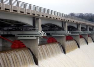
The Sélingué Dam
(left) is used
for both hydro electric power and irrigation purposes and two
others dams at Sotuba south of Bamako and Markala are both used
to irrigate neighbouring lands for farming purposes.
Although a land locked country, the presence of the Niger
River actually makes Mali Africa's third ranking fish producer
and the fishing industry employs thousands of fishermen
providing much needed work and income for the poorest in
society.
After the Niger River leaves Mali is progresses through
Niger flowing through its capital Niamey and is joined by a number of tributaries including the Faroul, Dargol, Sirba, Garoubi, and Tapoa.
For most of the year the river is very shallow as it runs
through Niger, making it unsuitable for transportation and there
are a number of rapids.
Work is currently being undertaken on the Kandadji dam (above
right) on the
Niger about 112 miles north-west of Niamey which is expected to
complete in the next few years and will be over five miles long. The dam is intended to provide
water for the dry season as well as irrigation for land
downstream in addition to hydroelectric power.
The Niger River then goes on to form the boundary between Niger
and Benin before entering Nigeria and completing it journey in
the Niger Delta as shown below in this map of west Africa
detailing the route of the Niger River.
This video gives a good overview of the Niger
river and its role in the daily life of Mali.
 The Sélingué Dam
(left) is used
for both hydro electric power and irrigation purposes and two
others dams at Sotuba south of Bamako and Markala are both used
to irrigate neighbouring lands for farming purposes.
The Sélingué Dam
(left) is used
for both hydro electric power and irrigation purposes and two
others dams at Sotuba south of Bamako and Markala are both used
to irrigate neighbouring lands for farming purposes.